Context
Since 2022, the Guiana forest has been affected by a worrying phenomenon of decline: many trees are dying on the spot, weakening the balance of this unique ecosystem. The causes are probably linked to climate change, particularly El Niño/La Niña episodes, which severely disrupt natural cycles.
In 2024, an initial internship enabled experimental mapping of the decline using machine learning techniques. This approach paved the way, but it showed its limitations: it was difficult to generalise to the entire Guiana forest and was likely to produce many false detections.
The 2025 project aims to go further:
Implement a method based on deep learning, which is more robust and capable of adapting to different areas of French Guiana and other tropical forests.
Better characterise the extent of the phenomenon and produce reliable maps.
Demonstrate the value of using advanced artificial intelligence architectures for environmental monitoring.
Activities carried out
- Reproduction and modernisation of the work from the previous internship, with a reimplementation of the methods initially developed in R into the Python language.
- Implementation of a new data annotation protocol, designed to enrich the training set, based on the verification of predictions from the model developed in 2024.
- Completion of the first training sessions for a deep learning model applied to a pilot area (Trinity).
- As the work is still in progress, it is not possible at this stage to draw definitive conclusions about the value of the proposed new approach.
The project in figures
Together
ONFI & ONF French Guiana: combining tech and local knowledge to protect forests
IA
AI in action: Random Forest and U‑Net to analyse forest damage.
Project details
Intern: Iris Dogan
Supervisor: Dr Cédric Lardeux (Expert in cartography and remote sensing Martin Dizier (Geo Data Scientist)
Monitoring this phenomenon in the field is difficult due to the vastness of the forest areas, limited accessibility and lack of infrastructure in many areas. In this context, remote sensing is used as a complementary tool to field observations. Satellite imagery, whether optical or radar, provides a global view of forest areas and detects their changes at different scales. The integration of these data into classification or segmentation methods opens up prospects for analysing the dynamics of forest decline and strengthening forest management tools in French Guiana.

Mapping of the location of tree decline. Sources: ONF, IGN, Airbus and CNES, 2023.
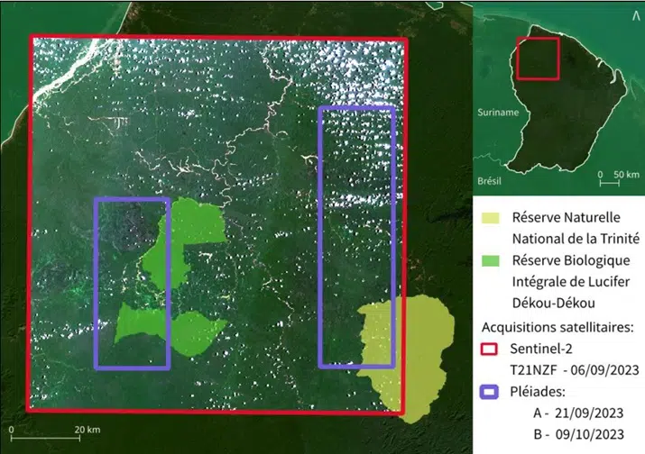
Mapping of the study area. Sources: ONF, Manon Levistre, Esri satellite. September 2025.

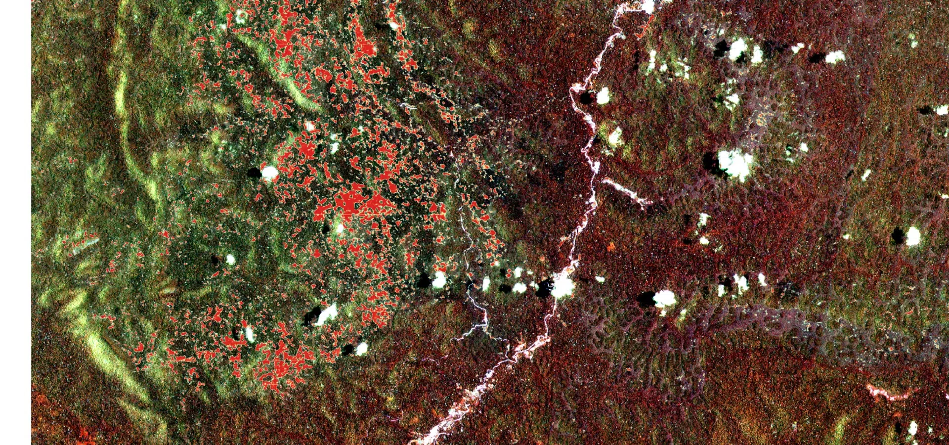
Mapping1 of predicted dieback by AI (deep learning) on a Sentinel 2 acquisition

Map 2 of AI-predicted dieback (deep learning) on a Sentinel 2 acquisition

Map 3 of AI-predicted dieback (deep learning) on a Sentinel 2 acquisition
Expected results
Result: strengthened forest management tools in French Guiana and a sustainably preserved natural heritage.
- Budget
- 40 - 50 000€
- Partners
- ONF Guyane (RDI)
- Beneficiaries
- ONF Guyane (RDI)
- Donor
- ONF
Other projects to discover

South America
TerrAmaz - Amazonian Territories
TerrAmaz - Amazonian Territories is a programme that supports the development of Amazonian territories.
See the project
Africa
Forland: Monitoring deforestation and encroachment on forests in Ghana
Development of a deforestation monitoring system for B-BOVID in Ghana, including mapping, risk analysis, a digital platform and training to support RSPO certification.
See the project
Africa
Technical assistance to Algeria to promote sustainable forest management and fire prevention
Support for Algeria to strengthen sustainable forest management, improve fire prevention, establish an integrated fire management system and develop forestry expertise.
See the project