Context
Sustainable land management faces increasing challenges such as deforestation, the restoration of degraded areas, and growing pressure on natural resources.
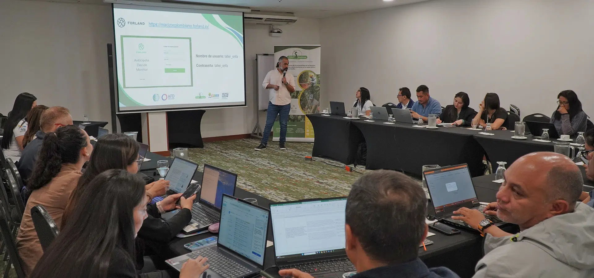
To address these issues, Forland was created as a collaborative web platform based on open-source software, developed by ONF International and implemented in the region by ONF Andina.
Its design integrates remote sensing, spatial analysis, monitoring, and participatory processes that facilitate territorial and environmental planning, ensuring transparency and strengthening local capacities.
Forland seeks to democratize access to advanced technologies, adapt to the specific needs of each territory, and promote informed decision-making by local governments, institutions, and communities.
Its implementation in Latin America and the Caribbean — with experiences in Colombia, Peru, Brazil, and Ecuador — as well as in Europe, Africa, and Asia, demonstrates its versatility and reliability as a technological solution.
Through its open and collaborative approach, Forland stands out as an innovative tool that promotes conservation, sustainable development, and territorial governance.
Activities carried out
It has been implemented in various projects, highlighting activities such as:
- Information centralization
- Indicator monitoring
- Support for land-use planning processes
- Integrated territorial management
- Field data collection
- Scenario simulation
- Strengthening the technical and technological capacities of institutions
Project details
Forland is a web platform based on open-source software, accessible to local governments, institutions, and communities. It integrates several technological components:
Web Mapping
A space for viewing and navigating geographic information. Compatible with vector and raster data and supports data publication.
Web Reporting (Dashboard)
Generates customized statistics, charts, and reports. Allows the integration of indicators, story maps, and multimedia (photos, videos, reports).
Web Processing
Online processing and analysis through scripts (Python, R, GDAL, QGIS). Includes modeling, simulation, and multi-criteria analysis, as well as automation of tasks such as deforestation monitoring.
User Management
A flexible system for managing accounts, permissions, and profiles, allowing data and functions to be filtered according to user roles.
Specialized Modules
- Deforestation monitoring using satellite imagery (Sentinel-1, radar), with frequent updates and automatic change detection.
- Deforestation risk simulation based on historical, social, and environmental variables.
- Integration of social mapping with data collected by local communities.
- Land-use indicators combining technical and social criteria in multi-criteria analysis to identify areas suitable for conservation, restoration, or production.
Field Data Collection
Through mobile applications (QField), even offline, with automatic synchronization of georeferenced surveys and forms.


Expected results
- Ownership and independence in information management
- Integration of new technologies by stakeholders
- Democratization of information use
- Easy and efficient access to information
- Access to spatial information for non-experts
Other projects to discover

South America
TerrAmaz - Amazonian Territories
TerrAmaz - Amazonian Territories is a programme that supports the development of Amazonian territories.
See the project
Africa
Forland: Monitoring deforestation and encroachment on forests in Ghana
Development of a deforestation monitoring system for B-BOVID in Ghana, including mapping, risk analysis, a digital platform and training to support RSPO certification.
See the project
Africa
Technical assistance to Algeria to promote sustainable forest management and fire prevention
Support for Algeria to strengthen sustainable forest management, improve fire prevention, establish an integrated fire management system and develop forestry expertise.
See the project