Context
Cyclone Chido: Mayotte’s forests severely affected
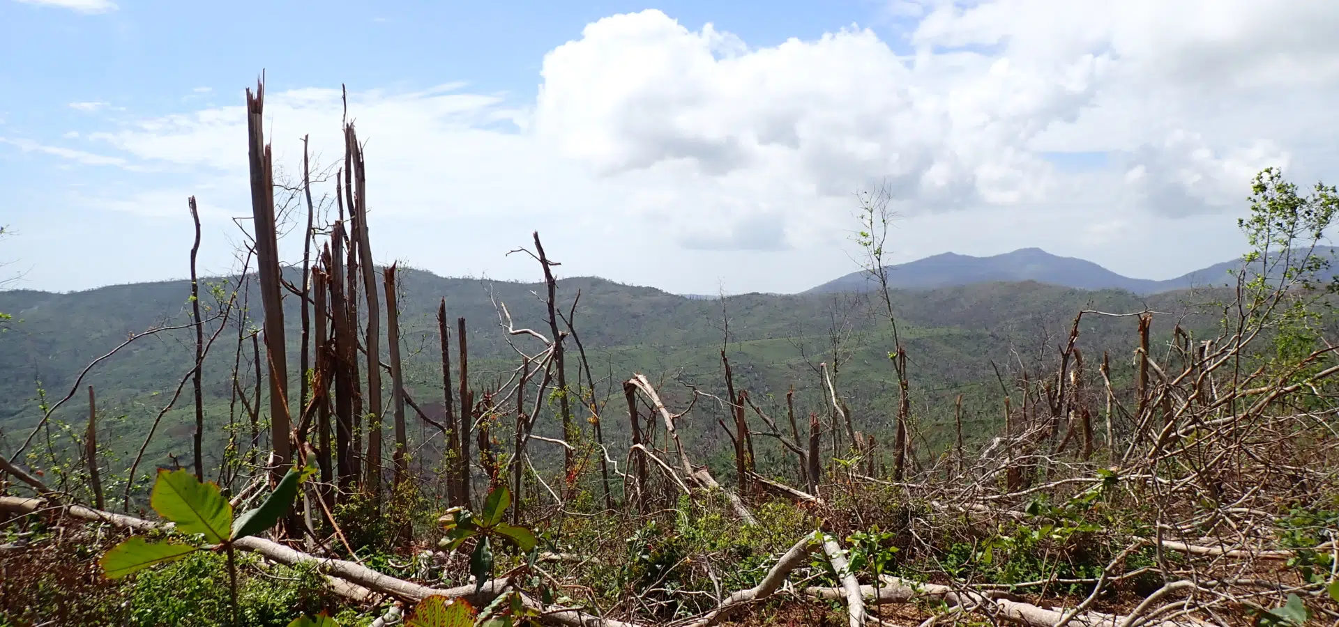
Cyclone Chido caused significant damage to Mayotte’s forests, uprooting thousands of trees and weakening the soil. This destruction increases the risk of flooding and threatens the island’s unique biodiversity.
In response to this emergency, the ONF, together with its subsidiary ONF International and its partners, is launching a restoration programme involving reforestation, monitoring of affected areas and sustainable ecosystem management. The objective is clear: to protect the forests, support rural communities and preserve Mayotte’s natural heritage.
Activities carried out
Nine maps were produced to show the damage in each forest in Mayotte, with a clear indication of the level of severity.
The project in figures
7,000 hectares of forest surveyed: using drones and artificial intelligence, windfall areas are mapped and the severity of the damage assessed.
0,25 ha
Precise mapping of Mayotte's state-owned forests, 0.25 ha grid
1 125 ha
Three forests in Mayotte—Combani, Voundze and Dapani—covering a mapped area of 1,125 hectares.
IA
Semi-automatic method → pixel classification to detect felled trees
Project details
At the request of the ONF, ONF International conducted an impact study after Cyclone Chido in Mayotte.
Across nearly 7,000 hectares of state-owned and departmental forests, the team used drones and artificial intelligence (deep learning) to map windfall and classify the severity of the damage. Working closely with the ONF Mayotte, field assessments were used to calibrate and validate the analyses.
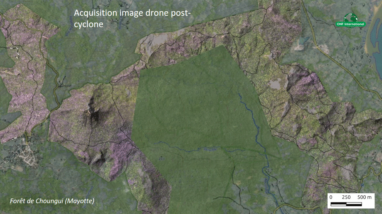
Post-cyclone drone image acquisition, Choungui forest, Mayotte
Expected results
ONF International has mapped the damage caused by Cyclone Chido to the forests of Mayotte.
Accurate maps show the condition of the forests and help to plan their restoration.
- Budget
- 2 X 20 000€
- Partners
- ONF MAYOTTE
- Beneficiaries
- ONF MAYOTTE
- Donor
- ONF
Other projects to discover

South America
TerrAmaz - Amazonian Territories
TerrAmaz - Amazonian Territories is a programme that supports the development of Amazonian territories.
See the project
Africa
Forland: Monitoring deforestation and encroachment on forests in Ghana
Development of a deforestation monitoring system for B-BOVID in Ghana, including mapping, risk analysis, a digital platform and training to support RSPO certification.
See the project
Africa
Technical assistance to Algeria to promote sustainable forest management and fire prevention
Support for Algeria to strengthen sustainable forest management, improve fire prevention, establish an integrated fire management system and develop forestry expertise.
See the project